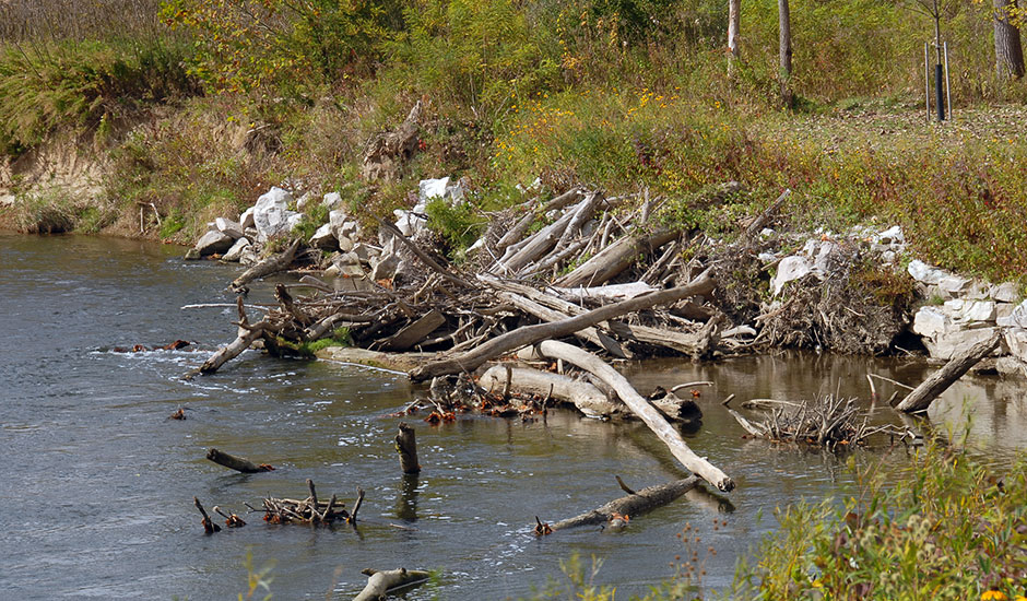
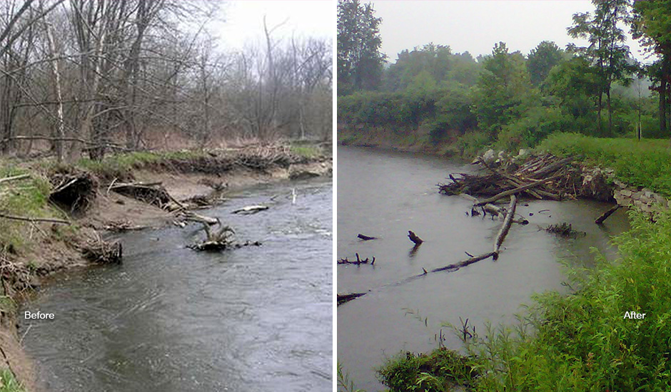
Severe bank erosion along the Cuyahoga River within Cuyahoga Valley National Park was threatening the stability of a primary roadway servicing Cuyahoga and Summit Counties as well as Cleveland Metroparks. Wade Trim performed river assessments and geomorphic surveys and prepared a hydrologic model and scour analysis to determine the degree and extent of active bank erosion at this location. Changes in the upstream watershed had resulted in channel instability, including extensive areas of bank erosion, sediment deposition and lateral instability throughout the upstream reach of the river. A robust set of bank stabilization methods were evaluated based on the assessments.
A bioengineering solution was selected as the preferred design to blend with the natural setting, using rock toe protection and live branch layering as well as areas of log-toe and root-wad revetments to improve fish habitat. Budget limitations were a factor in determining the locations and strategies to address the bank instability. Permitted through federal and state regulatory agencies, the project met all budget, engineering, environmental and aesthetic goals. More than 400 lineal feet of bank stabilization was installed, achieving the project performance criteria for bank stability and plant coverage within one year. Sediment loading to the river due to erosion has also been significantly reduced immediately downstream of the project.