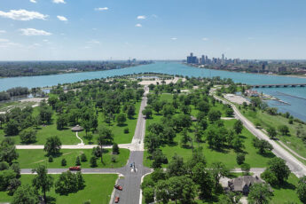
The historic Belle Isle Park, a 982-acre island located in the Detroit River, has realized increasing transportation network and parking demands due to a significant rise in visitors since it became a state park in 2014. According to the Michigan Department of Natural Resources (MDNR), attendance was over 5.2 million in 2021. To accommodate and enhance visitor access and travel throughout the park, the MDNR—in partnership with the Michigan Department of Transportation (MDOT) and Belle Isle Conservancy—launched a comprehensive multimodal mobility study for improvements to transportation, parking, and traffic management. Led by Wade Trim, the study will recommend a phased mitigation strategy for implementing innovative and sustainable improvements to multimodal transportation for various modes of travel including vehicles, pedestrians, bicyclists, and buses. Transportation improvements will focus on enhancing traffic operations and safety throughout the park, providing a plan to help visitors find their way around with additional wayfinding and enhanced parking while preserving the park’s natural, historical, and cultural resources.
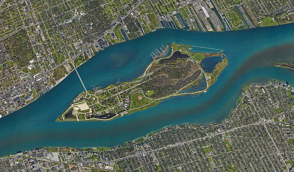
An extensive data collection phase was conducted in July 2022, which included collection during the highly attended Belle Isle Kite Festival. A total of 206 cameras were placed throughout the island, collecting 3,136 hours of video footage used for counting vehicles, buses, pedestrians, and bicycles at approximately 60 intersections and driveways. Conflict data was captured at popular park locations such as the beach area, James Scott Fountain, Sunset Point, and Kid’s Row. Parking utilization data and patterns for the entire island are being analyzed from high resolution images taken using a low-flying aircraft equipped with a camera. The images were later stitched together to create orthomosaic image maps, ultimately producing an aerial photo of the entire island for 38 hours over a five-day period. Data collected is also being used for traffic modeling of alternative improvements and provide insight into operations for various conditions including typical days and high-visitor days during the summer. Multimodal infrastructure solutions and recommendations will be made to improve traffic operations and circulation throughout the park.
A stakeholder communication plan, which includes visitor surveys, is being developed to recommend strategies to reach all stakeholders such as vendors, agencies, partner groups, and the community. Three rounds of meetings will be held in 2023. The first round will gather stakeholder input for the technical team to understand current stakeholder perspectives and challenges for consideration in developing potential mitigation strategies. The other rounds will present proposed mitigation strategies and, subsequently, the final plan for stakeholder feedback. The study is scheduled for completion by December 2023.