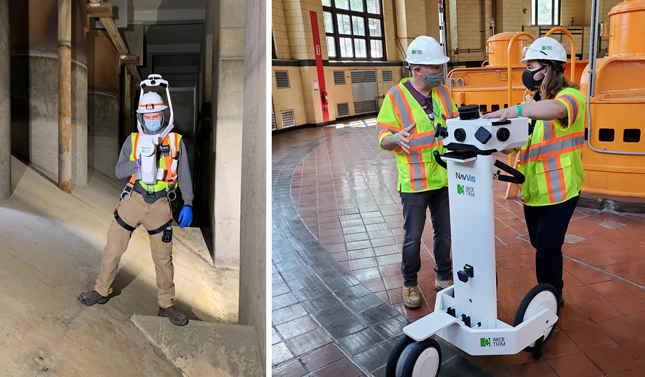
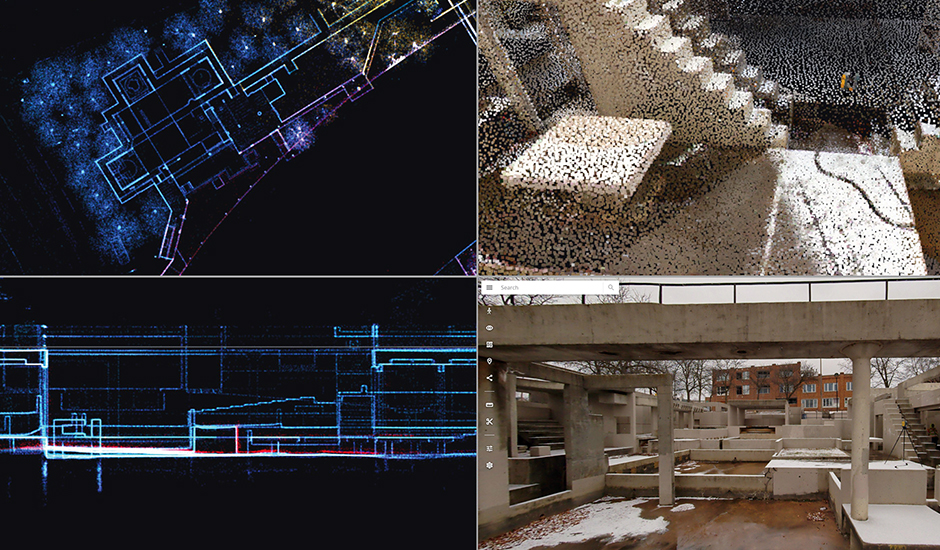
Data collected with reality capture technologies, such as drones, terrestrial survey, and mobile laser scanning devices, can strengthen engineering design and construction management capabilities during and beyond traditional project life cycles. Wade Trim’s Reality Capture Services team leverages surveying and 3D reality capture technologies in innovative ways to capture existing conditions data for many project-related needs. Point cloud and survey grade data, 360-degree panoramic imagery, and high-quality media can be delivered in the single cloud-based platform “NavVis IVION Enterprise” that makes immersive design collaboration as simple as being connected to the internet. Our team’s expertise, growing work experience across the country, and assistance providing NavVis real-world feedback on project performance has led to Wade Trim’s designation as one of only 14 NavVis preferred Mapping Partners in the Americas.
Based in Munich, Germany, NavVis serves surveying, AEC, and manufacturing industries around the world. The company’s equipment and software allow project teams to capture data and place full project environments into reality-based virtual “digital twins” that improve coordination between owners, design teams, contractors, and the public.